Concluding my series on Palm Springs and last week's Aerial Tramway, I write about Indian Canyons this week.
Indian Canyons: a happy accident
Usually I’m very good about directions and where to go. It’s maybe why I always feel good about traveling and not having fear of getting lost. But when I was in Palm Springs a few weeks ago, that self-assured characteristic fell apart.
My intent was to go to Tahquitz Canyon, which is a natural preserve just on the western edge of town. The trail network didn’t look that difficult – a nice figure eight loop under two miles. I might encounter the 60-foot waterfall at the main trail’s end, if there was enough water flow.
But on South Palm Canyon Drive, I made a wrong turn. I saw I sign for Tahquitz Canyon Visitor Center on the way there. It didn’t occur to me that it was the way to the trailhead. Instead, I ended up its sister preserve area, Indian Canyons, which was a much bigger area with a more extensive network of trails. There were at least twelve to choose from, and I wasn’t sure which one to hike.
The Native American retreat
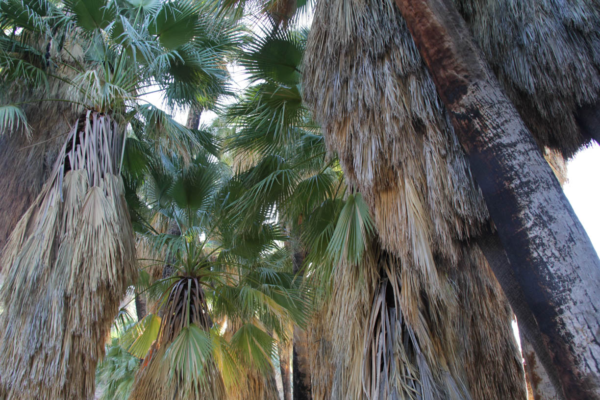
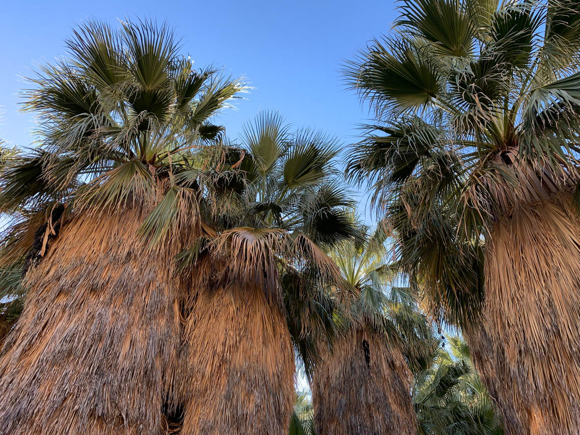
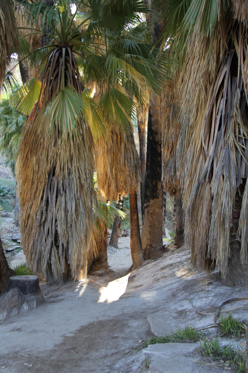
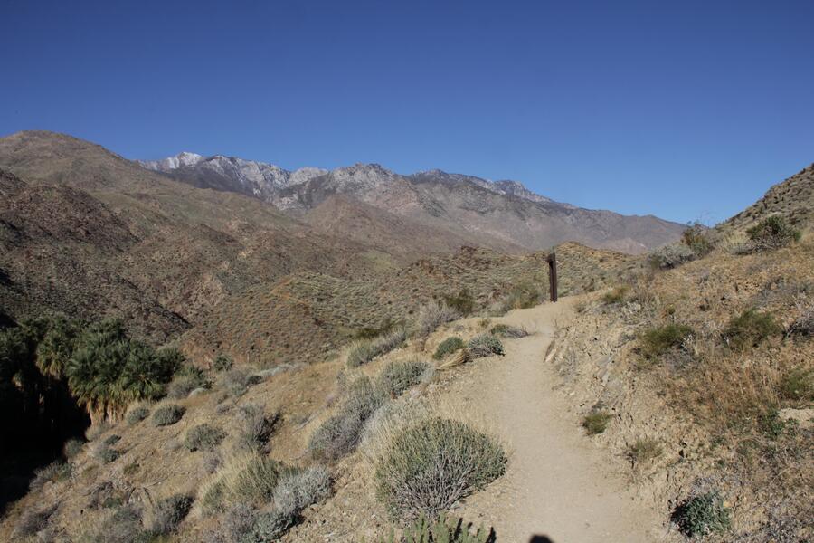
I ended up going to the end of the road of Indian Canyons, through scrubby desert landscape for about two miles. In the last quarter mile, a narrow switchback brought me to a large dirt lot, with an single-story adobe building housing a trading post. The trailhead marker wasn’t obvious, so I just simply headed down into a canyon with thick groves of palms.
Had I visited here in mid-July or any time when the temperatures soared well above 100, this would’ve been a wonderful to cool off. But in January, it was a little colder than I was anticipating, Still, the palms form a canopy that nearly blocked out the sunlight. I could understand why the Agua Caliente Indians would come here for respite in the summer heat.
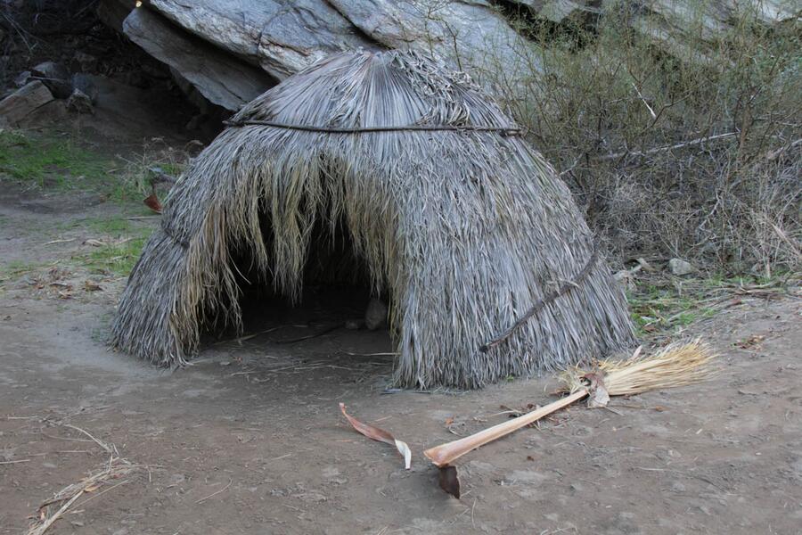
There are also these tiny grass huts on a sandy clearing, which may have been replicas of the housing that the Agua Caliente tribe lived in. Now there are just a place for shade for kids and their picnicking families.
Onward I go
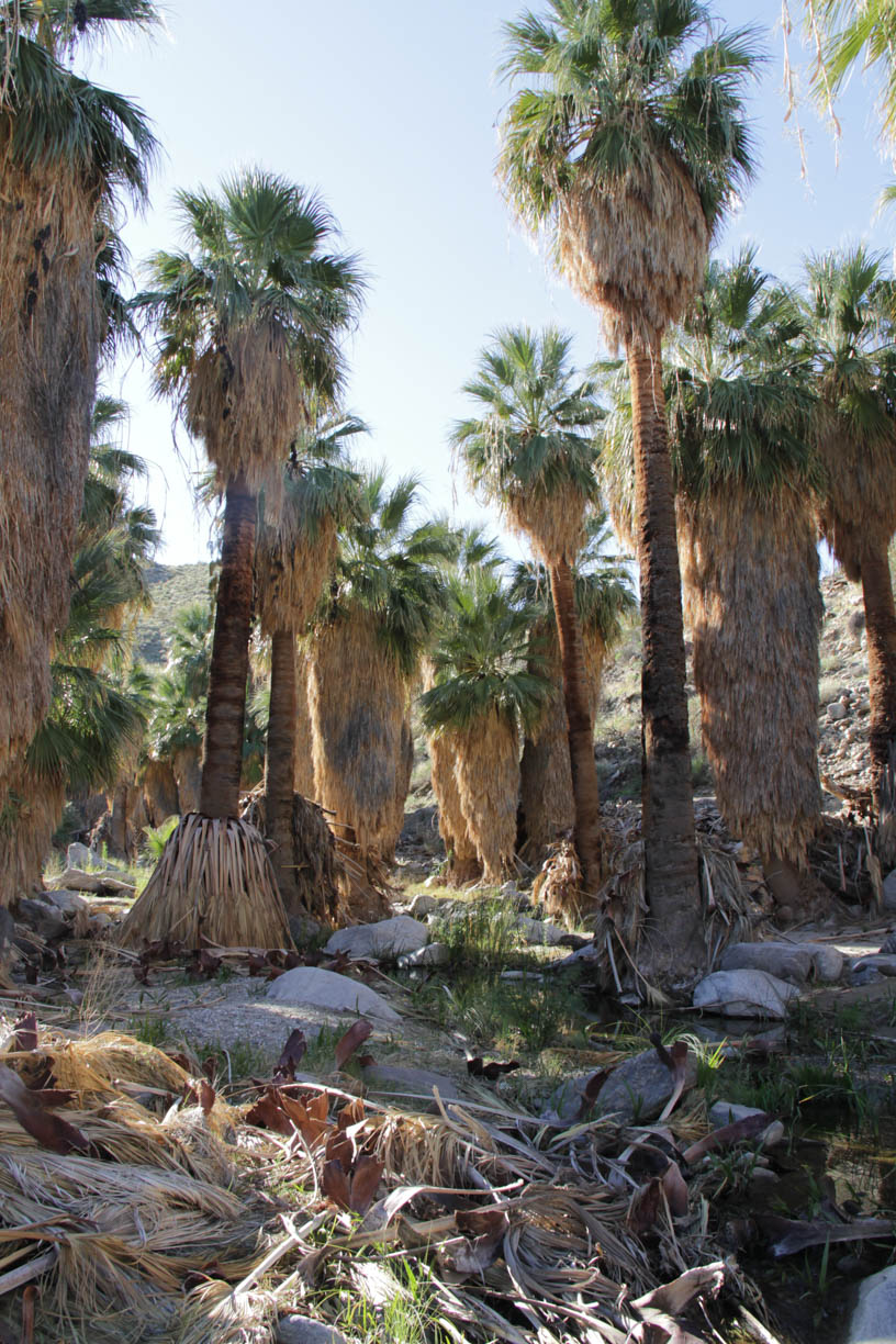
With few people around, I continued into the canyon for about a mile. All the while, I encountered palms of varying heights and widths, growing crowded together and some fallen over. The creek snaked its way around all of them, with its muddy water flow often stagnating in ponds just a few inches deep. I was happy to come to Indian Canyons, just to practically have it all to myself.
When I am on an unfamiliar trail, it always seems much longer than the actual distance. At the start point, it appears to go much quicker. Soon after covering that distance, I arrived at a fork that could have taken me up a bluff, destination unknown. Or I could take another trail fork that would provide an easy loop back to the trading post. I chose the latter, and true to my assumptions, it seemed to be a much faster hike.
A stark contrast
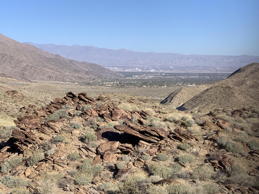
Really, it wasn’t. It turned out to be almost twice as long in length to head back. But the Victor Trail provided a stark contrast to the palm canopy that was about 70% of my terrain on the Palm Canyon Trail. It illustrated the variation of Indian Canyons. It was all rocky and parched, with plenty of steep ascents and descents, and different types of desert foliage growing everywhere, especially yucca. However, it did have some fantastic views.
Just like a far-off mirage, I viewed the Palm Springs metro area from the tops of the trail, some five miles away. It stirred mixed feeling inside, because I normally escape civilization on hikes like this. I wasn’t going to get it here or at the Aerial Tramway, because this area has grown like crazy since I was last here, 30-plus years ago.
But I still enjoyed this unexpected detour of Indian Canyons. Of course, next time I’m here, I’m going to Tahquitz Canyon.